
large 1024x809 923kB
huge 3115x2460 7.2MB
On June 19th, Robin and I started out for Norman Wells, NT. My plan was to fly to Massena, NY, near the Ontario border, and then on to North Bay, ON to clear customs. However, the weather was bad and, right from the start, plans went out the window. We made it as far as Saranac Lake, NY and were stopped by low clouds. Really low clouds.
A cold front running right along the US/Canada border in upstate New York was causing the low clouds and we just weren't getting through. After sitting around most of the day and making another failed attempt mid-day, we were able to duck under the clouds late in the afternoon. However, by that time customs had closed at North Bay and Kingston, leaving Ottawa as our only option.
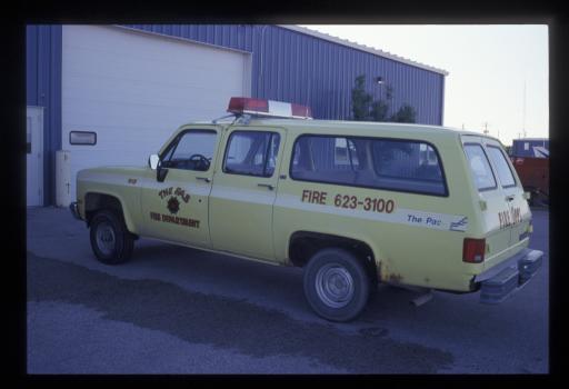
The people at Ottawa were really nice to us, though Robin was a little leery about mixing it up with 737's and such. The customs people were fine, seemed more concerned with our pepper spray than the rifle, and the FBO took care of finding us a hotel and driving us to and from. The Customs agent explained how the most important thing about the pepper spray was the labeling. If it was labeled for protection against animals, that was fine. If it was labeled for protection against people, he'd have to confiscate it. I knew about this ahead of time so we were permitted to keep the pepper spray.
A repeating theme of our travel in Canada was just how great the people were. On the way out the next morning, Ottawa ground control warned me about something hanging from my wing. I guess he'd never seen grab-lines on a float plane before. Then he said, "Nice paint job". There sure are nice people in Canada.
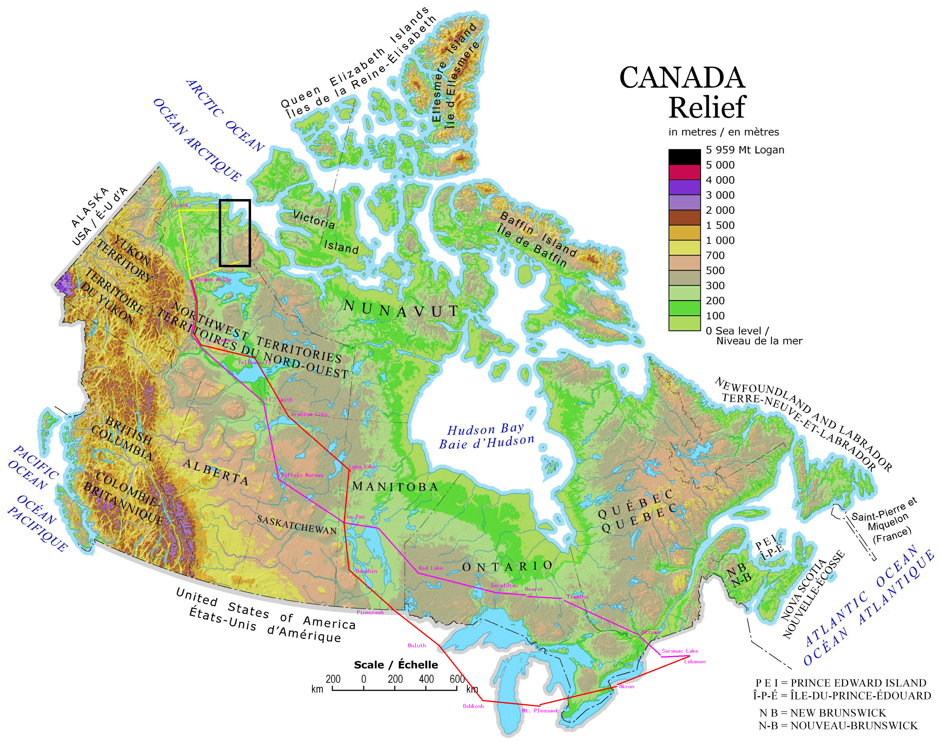
Ontario is really big. When I was planning for this trip I was a little taken aback at how many maps I needed to buy to fly across Canada. Well, a large part of that is just crossing southern Ontario.
Leaving Ottawa, we flew to Timmins, Hearst, and Geraldton where we stopped for the night. Here, we figured to finally get out the tent liked we'd planned. Ottawa was a bit of an unplanned anomaly that way, though in the end we alternated tenting and finding a hotel.
The airport was kinda dead but we eventually found some guys who work on the fire bombers. They didn't know where we'd be okay to pitch the tent so we just picked a spot off to the side and hoped it'd be okay.
Then the guys gave us a tour of one of the CL-215s that was under their care. These are large flying boats purpose-built for firefighting. They have two 800-gallon tanks that can be filled in 8 seconds from little scoops that get lowered into the water as the plane skims along the surface of a lake. Pretty impressive machines.
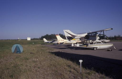
As evening came and we were about to set up the tent, the airport manager came along and said we could just camp right behind the plane. Much more convenient than carrying our stuff over to where we were going to. So here's our first campsite for the trip.
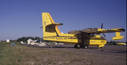
And taking a step back, you can see our next door neighbor. That's a Canadair CL-215.
These planes were around, of course, to fight forest fires which were scattered all over western Ontario this summer. In fact, if you look closely at the CL-215 parked beside us at Geraldton, you'll notice it says MN-DOT on the side. Ontario was bringing firefighters in from all over to help and this one was from Minnesota.
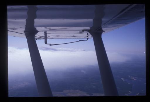
We'd flown through some smoke on our way to Geraldton and the next day, on our way to Red Lake, we saw this fire.
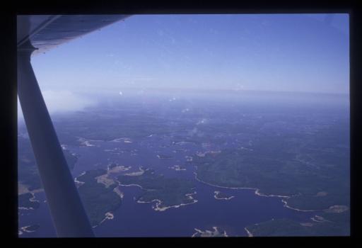
I'd climbed up over the smoke here and at 6,500 feet, this is as high as we got for the entire trip. This next picture shows the edge of the smoke from a fire but also gives an idea of just how much water is up in Canada. And we weren't even very far north yet.
After Red Lake, I wasn't entirely sure which way to go next. The most direct route was to stay east of Lake Winnipeg, but that was also a lot less populated and it might be difficult to find fuel for the plane. Another option was to could cross the lake and go up the west side. That would be a substantial water crossing and somewhat out of the way, but there seemed to be more airports over there.
However, on reaching Red Lake the decision was postponed. Flight Service reported major thunderstorms in the vicinity of Winnipeg and stretching north, blocking any route we might want to take. It was sunny and beautiful where we were, but we headed downtown to find a motel.
Turns out that Red Lake is the Norseman capital of the world. The Noorduyn Norseman, aka the Thunder Chicken, is a famous Canadian bush plane and I was delighted to be able to see a few.
The airport is a ways out of town but the seaplane base was right in the middle of downtown. We saw this arrangement several times in Canada but, not being familiar with the area, I tended to stick to the airports.
When we walked past the seaplane base, I saw a plane that I had been thinking about buying. I wanted a plane that could carry a bit more than the Maule, especially on amphibious floats. One that had made it to the short list was the Bush Hawk XP. Not only did it have an impressive useful load on floats, it was surprisingly fast for a floatplane.
I'd talked to Found Aircraft about buying their demonstrator for this trip, but it turns out that SARS got in the way. The demonstrator was registered in Canada of course and would need to be converted to US registration for me. An FAA inspector was going to be in Toronto to go over paperwork in early March but because of the WHO's pronouncement on SARS, he postponed the trip. This didn't give us enough time to make everything happen before the trip so I dropped the idea.
Now there, at the seaplane base in Red Lake, was the very demonstrator aircraft I'd been considering. So we talked with the pilot some and I got to actually sit in the plane, I'd only seen pictures before. It would have been nice.
Flight Service had predicted that we wouldn't leave Red Lake for a couple days at least, the storm wasn't really moving off like you'd expect, but the next day we found that the storm front had dissipated overnight. I decided we had sufficient fuel to make The Pas by going up the east side of Lake Winnipeg so off we went.
Arriving at The Pas, we found that the winds were blowing straight across the runway at 21 knots gusting to 29. Furthermore, the runway was only half its normal width because they were paving it half at a time. Everyone came out to watch but I managed not to give them an unpleasant show.
Here we again found fantastic hospitality. The storm had rebuilt, and again we were not going any further today, so we prepared to spend the night. The airport manager said we could lay our sleeping bags out on the floor of the conference room in the admin building. He also pointed us to a vehicle we could use to go get some food. First time I've ever had a courtesy car with flashing lights and siren.
The next day the storm was still hanging around so we did too. By now we're thinking that we're about half way across the country and how much time has this taken? Are we going to be late for the trip? Man, that would suck.
Fortunately the weather passed overnight and we were a little more than halfway along. Perhaps feeling a little pushed because the previous three days have been two half days of travel and one of no travel, we made three long hops to Buffalo Narrows, SK, Fort Smith, NT, and Fort Simpson, NT. Getting to the Northwest Territories definitely made us feel like we'd made serious progress and, in fact, Fort Simpson was merely one hop from Norman Wells.
When I called Flight Service from Fort Smith, I was startled to hear there was a NOTAM that fuel was not available at Fort Simpson. This was a little disturbing since, as far as I could tell, I had no choice but to refuel at Fort Simpson if I was going to make it to Normal Wells. Yellowknife might have been close enough but I wasn't sure and the land in between was so empty that I really wanted to make sure I had sufficient fuel.
However, then Flight Service just suggested that we land at the "Town Strip", a gravel airstrip on the island right next to town. Sounded very convenient but the Canadian Flight Supplement (the bible for airport services in Canada) said they didn't have fuel either. In fact, it sort of looked like a private airstrip.
When I asked about this, Flight Service offered to call for me. He put me on hold, called the operator at the Town Strip, and let me know they had fuel available and were expecting me. Nice service.
Our flight from Fort Smith to Fort Simpson gave us our first look at the Great Slave Lake and then the MacKenzie River. We were getting close to the arctic now. The territory we'd flown over this day had been just incredible; we could go hours between seeing any evidence of human habitation.
The Town Strip at Fort Simpson was incredibly convenient in that it was right next to town though it was a little on the short side given how we were loaded. And, as town wasn't very large, we could just walk where-ever. So we checked into the one hotel in town and went out for dinner. We learned that it appears that every town in the far north has a Chinese restaurant. This one was called the Sub Arctic Wok. You'll notice they advertise pizza too. The two seem to go together in the north. The chinese food was pretty good by the way.
The hotel had very heavy drapes on the windows. We were now in the land of perpetual sunlight. I think we were still far enough south that it dimmed down about 3:00AM but it never got really dark. We wouldn't see dark again until we were on our way home.
The next morning we again got news of storms from Flight Service. In fact, just looking out the window showed dark skies. There were thunderstorms forming already and they would build along the Mackenzie River as the day went on. The briefer thought we'd be okay to go if we went soon but it looked grim outside.
So we headed for the plane and when we got there the rain was falling. We sat in the plane for about an hour, waiting for this cell to pass and then get out right behind it. This we did and about 15 miles west, down river, we were under blue skies and it remained sunny all the way to Norman Wells.
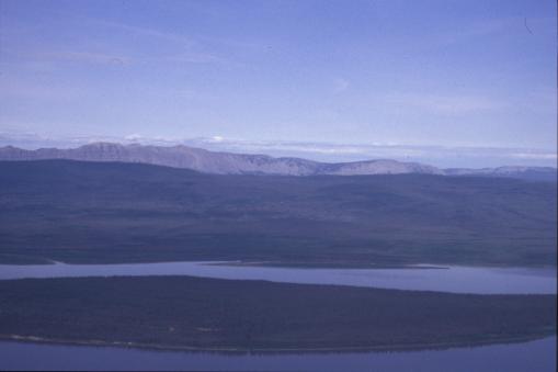
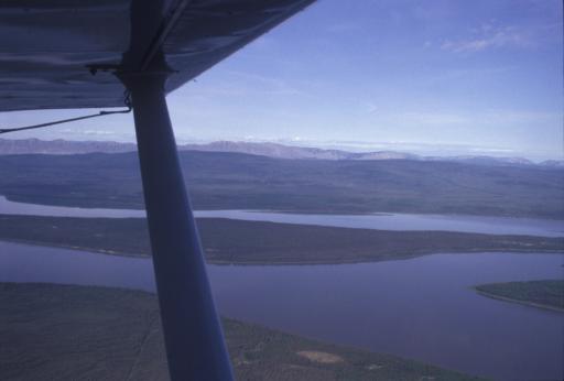
Flying along the MacKenzie, we could look to the west and see the MacKenzie Mountains. Our entire route of flight had been over low terrain except at the very beginning, passing through Vermont and northern New York. These were now real mountains but our travels were not to take us any closer than this. On some future trip I'd love to get into those mountains.
Continue with the canoe trip.